Earth System Data Science & Remote Sensing
Environmental problems are increasing globally in times of climate change and land use transformations. Earth observation technologies and modeling methods allow us to observe and quantify the associated changes in almost real time. However, the volume of data volume emerging from these sources require analysis techniques that are categorized as Big Data methods. However, such methods of data collection and analysis alone do not mean a deep understanding of processes to integrate the retrieved information content into management actions and decision making for society. The international, research-oriented M.Sc. program Earth System Data Science and Remote Sensing (MSc ESDS&RS) has therefore set itself the goal of equally covering the areas of technical skills, remote sensing and domain knowledge. In addition to in-depth methodological training, an individual specialization in an area of Earth System Science for an improved understanding of processes represents the core of this degree program. This is intended to train a new generation of earth system scientists prepared to meet the challenges of a data-rich world.
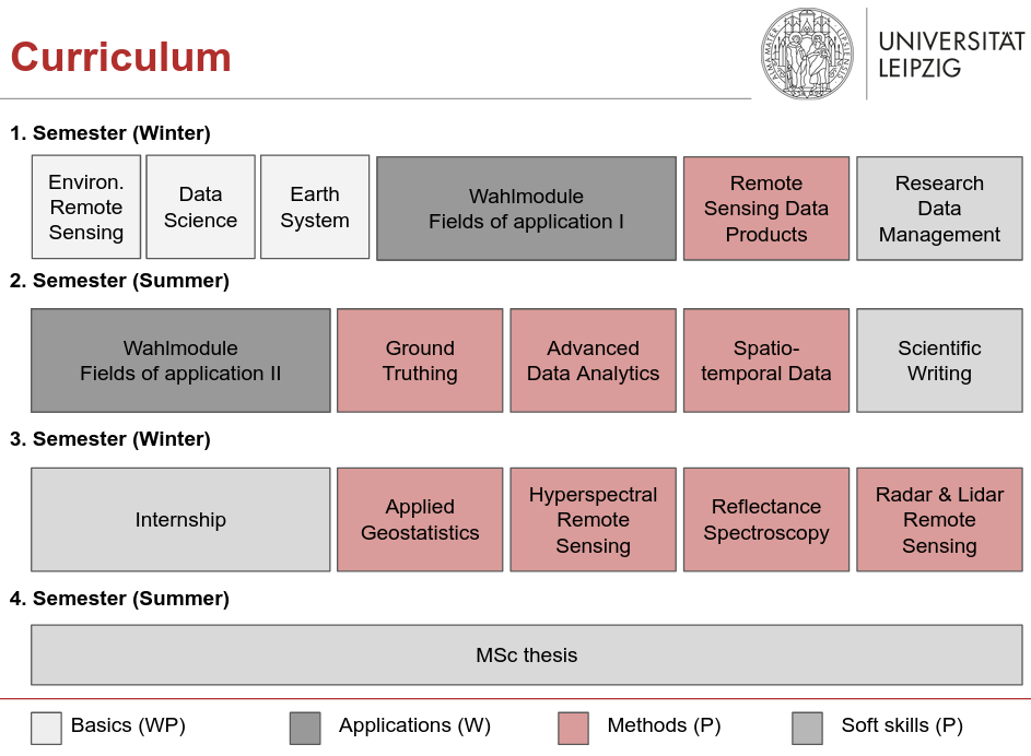
The curriculum is divided into four sections:
- Basics: In order to create a common knowledge base for our students with their different Bachelor's degrees, the first semester contains three introductory modules. Of these, students take two each, selected according to their prior knowledge in a way that fills existing gaps. The introductory modules cover the three areas of 'Introduction to Earth System', 'Introduction to Data Science', and 'Introduction to Environmental Remote Sensing'.
- Applications: This elective area, totaling 20 ECTS, is where subject specialization takes place. Various modules from the neighboring study programs can be taken and combined to develop an individual profile.
- Methods: These modules provide in-depth methodological training in the areas of data science and remote sensing. Our lecturers bring in their own research foci, so that the methods are learned in a research-oriented and up-to-date manner.
- Soft skills: In this section, cross-cutting skills are taught. These include data management as well as scientific writing. The master's thesis and a professional and research internship further enable the profile development.
Admission requirements
- B.Sc. degree in a geoscience, natural science, environmental science, or computer science/data science related field of study.
- At least 35 ECTS from the fields of geography, earth system science, geoscience, environmental science, life science, data science, environmental informatics, remote sensing, or GIS.
- Prior knowledge of statistics (min. 5 ECTS).
- Prior knowledge of a scripting language for scientific computing or a higher level programming language (e.g., Python, R, Julia, ...).
- English language skills at level B2
NOTE
Teaching is conducted in English.