Our research group deals with the impact of climate change on hydrogeological systems. We use geophysical and remote sensing techniques to investigate hydro-mechanical processes that may lead to natural hazards like earth surface deformation, erosion, landsliding, flooding and salinization both in terrestrial and coastal environments.

Introduction
The research group “Applied Near-Surface Geophysics and Remote Sensing”, led by junior professor Djamil Al-Halbouni, investigates research topics relevant to the human-nature interaction system. The group’s work focuses on subsurface water’s influence on natural hazards and its relationship to climate extremes. Characterizing water flow and availability, changes in the hydrological system (e.g., droughts, flash floods), and surface and subsurface deformation is essential to understand the processes that lead to short- and long-term hazardous effects. Such hazards include subsidence, landslides, and strong ground erosion, as well as the feedback onto natural ecologic systems such as stress on forests and plantations.
More broadly, the impact of groundwater/soil moisture and salinization on environmental dynamics within fragile ecosystems, particularly with regard to climate change and global warming, are challenges the group’s members address. Our compass also points towards the domains of of quaternary geology, geomorphology, geomechanics, geoarchaeology, and geoecology with a focus on landscape reconstruction processes and sustainable use of geosites in the framework of UNESCO Global Geoparks.
The variety of methods used by the group reveals the interdisciplinary nature of our research.
Methods
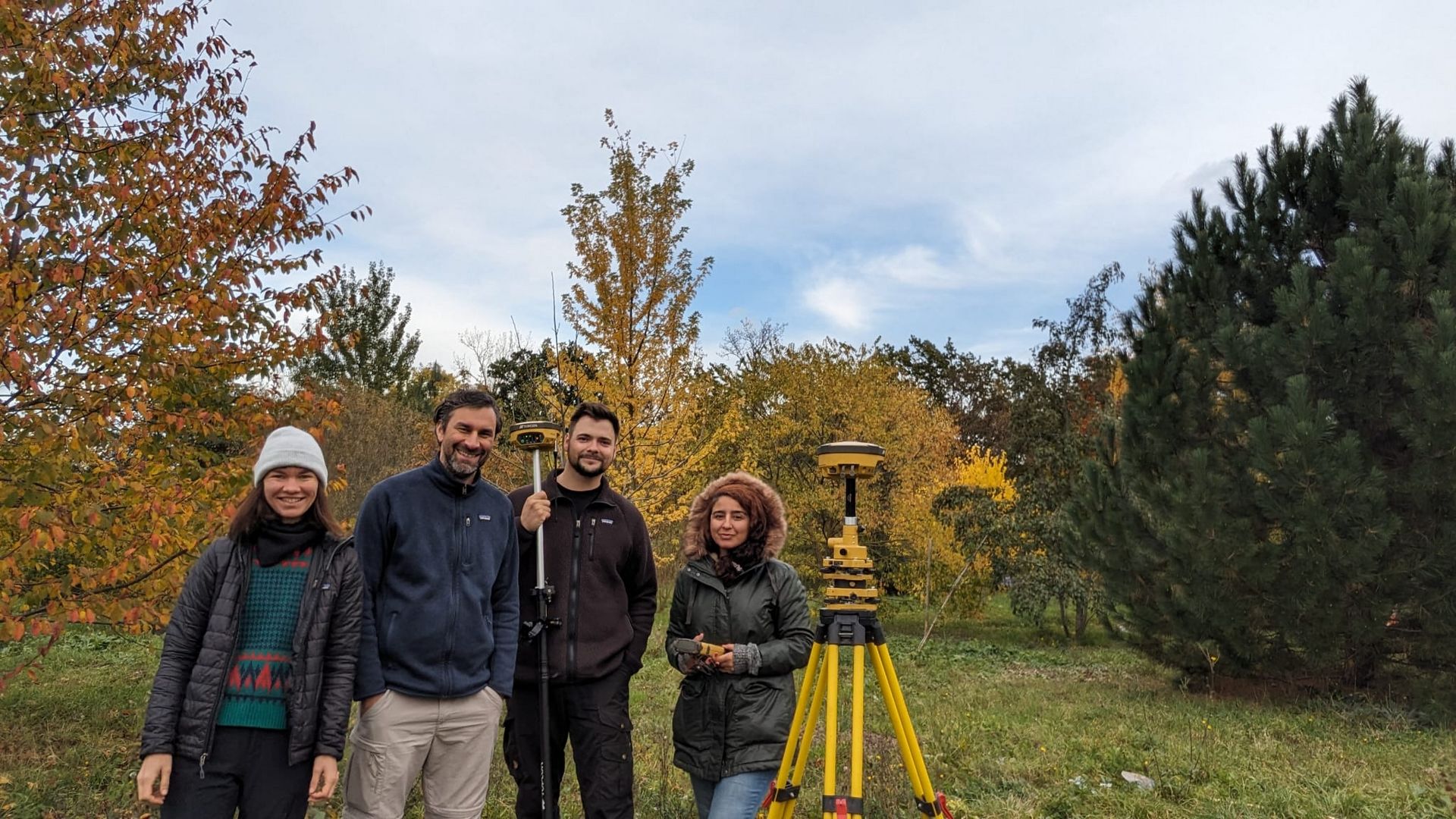
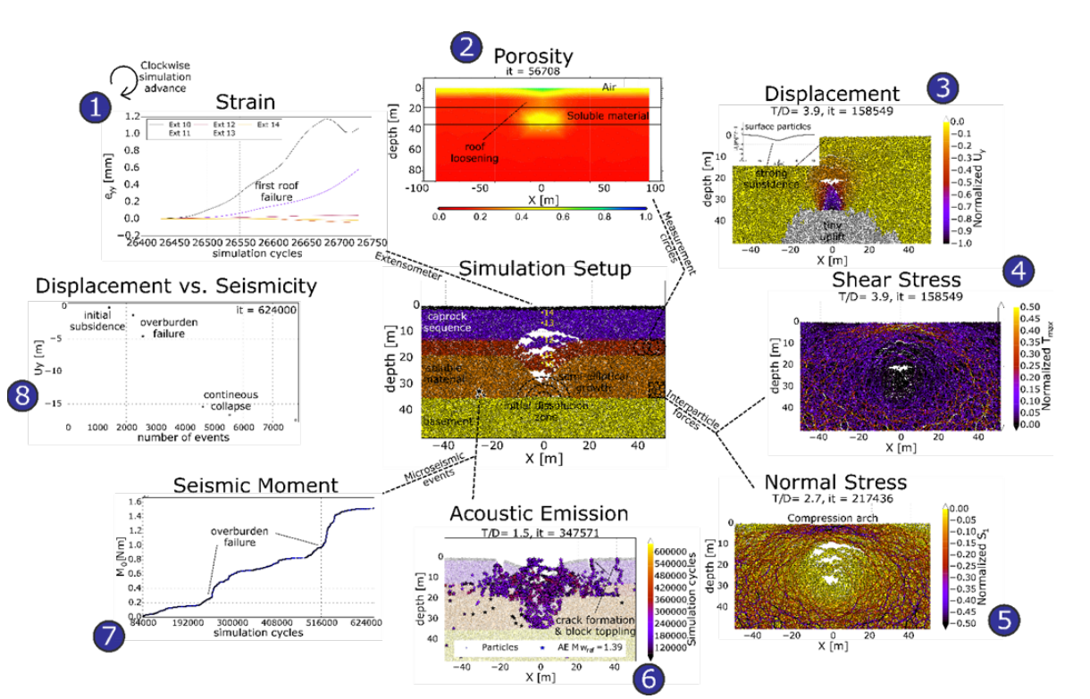
Applied methods are manifold and range from “classical” applied geophysical field methods, like ERT, GPR, SP, seismics, magnetics and gravimetry, to remote sensing methods like photogrammetry, GIS, satellite image analysis and pure field observations. Data is analysed by inversion techniques, numerical modelling with finite and discrete elements, and AI-based data science methods and image analysis.
Current research focus areas
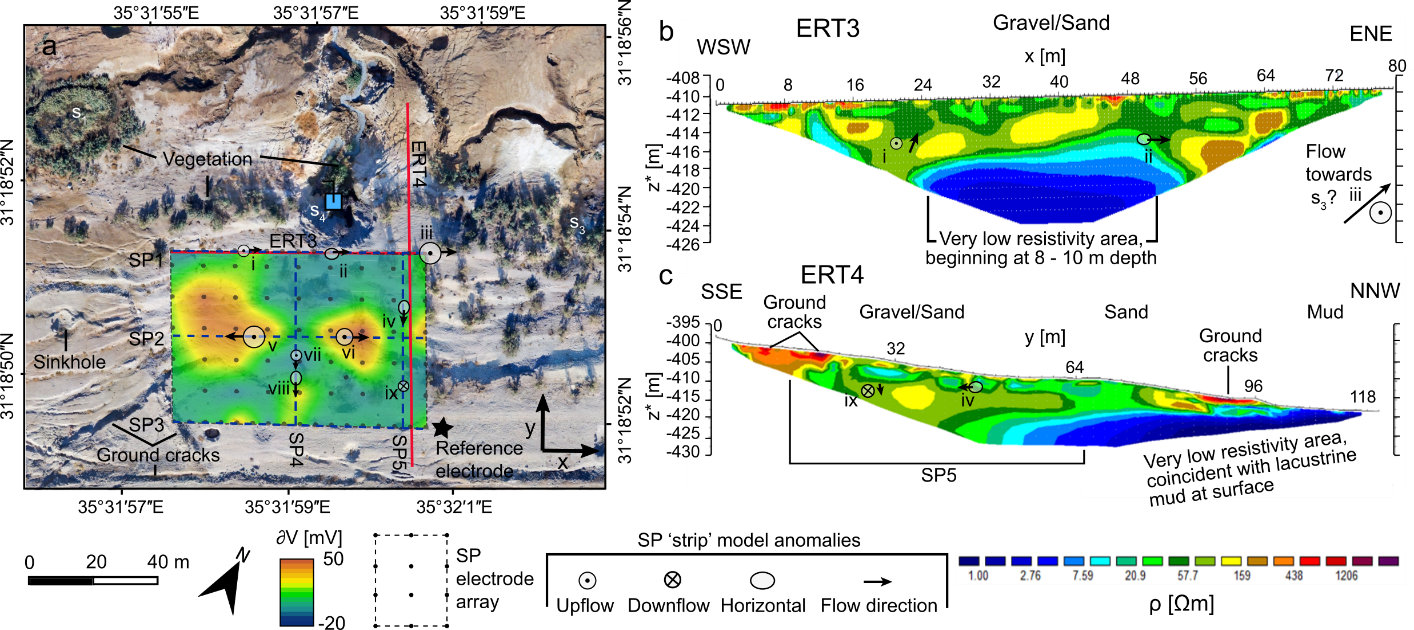
Current projects focus on soil-moisture effect on biodiversity changes and the feedback to climate change at German observation sites; subsidence phenomena and other erosion based natural hazards in karstic systems such as the Dead Sea, former mining regions of Germany, and in Turkey; and salinization in coastal areas and semi-arid regions. Upcoming projects involve the investigation of karst structures in the Geopark Granada. The projects are done in collaboration with researchers of the RSC4Earth.
OUR TEAM