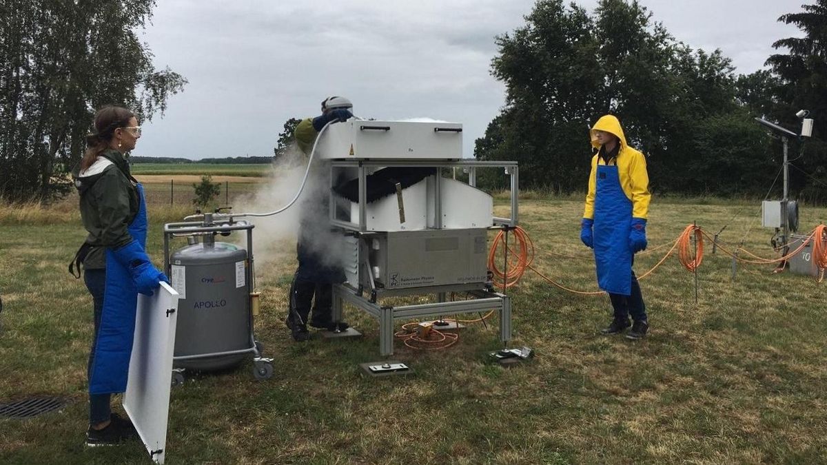
Ground-based remote sensing is a major tool to explore processes within the atmosphere over long time spans. Several different remote sensing methods are used in atmospheric science, they can be either active or passive.
In active remote sensing (e.g., RADAR, LIDAR, SODAR) radiation is emitted by the instrument and the receiver at the ground observes the amount of electromagnetic radiation which is scattered or reflected by atmospheric constituents. Passive remote sensing (e.g., microwave radiometer) detects only radiation emitted by the Sun or the atmospheric components like water vapor, oxygen or trace gases. Ground-based remote sensing measurements can be used to validate in-situ, airborne, and satellite-based observations.
We focus mainly on combining different active and passive ground-based remote sensing instruments to get comprehensive profile information of the atmospheric state (temperature, water vapor, cloud microphysics and cloud dynamics, wind, precipitation) and for power predictions for renewable energy facilities. We use these state-of-the-art measurements to develop or improve atmospheric retrieval algorithms. For that purpose, we use sophisticated approaches like optimal estimation techniques and machine learning. Since our instruments are mobile, we deploy them in different regions of high interest around the globe, like the midlatitudes of the Southern Hemisphere, the trade wind region of the Caribbean, and in the future possibly also in the Arctic.
Current projects
Arctic Amplification: Climate Relevant Atmospheric and Surface Processes, And Feedback Mechanisms
Period: 01.01.2020 – 31.12.2023
Funding: German Research Foundation
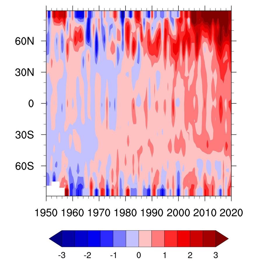
Planet earth has warmed on average by 0.87 K over the past 150 years. In the Arctic, the warming is much larger, which became most prominent over the last decades. Currently, the Arctic warming exceeds the increase of near-surface air temperature in the mid-latitudes by about 2 K. This phenomenon is commonly referred to as Arctic amplification.
Fusion of Radar Polarimetry and Numerical Atmospheric Modelling Towards an Improved Understanding of Cloud and Precipitation Processes
Funding: German Research Foundation
Cloud and precipitation processes are the main source of uncertainties in weather prediction and climate change projections since decades. A major part of these uncertainties can be attributed to missing observations suitable to challenge the representation of cloud and precipitation processes in atmospheric models. The whole atmosphere over Germany is since recently monitored by 17 state-of-the-art polarimetric Doppler weather radars, which provide every five minutes 3D information on the liquid and frozen precipitating particles and their movements on a sub-kilometer resolution, which is also approached by the atmospheric models for weather prediction and climate studies. Data assimilation merges observations and models for state estimation as a requisite for prediction and can be considered as a smart interpolation between observations while exploiting the physical consistency of atmospheric models as mathematical constraints. However, considerable knowledge gaps exist both in radar polarimetry and atmospheric models, which impede the full exploitation of the triangle radar polarimetry – atmospheric models – data assimilation and call for a coordinated interdisciplinary effort. The priority programme will exploit the synergy of the new observations and state-of-the-art atmospheric models to better understand moist processes in the atmosphere, and to improve their representation in climate- and weather prediction models. The programme will extend our scientific understanding at the verges of the three disciplines for better predictions of precipitating cloud systems by addressing the following objectives.
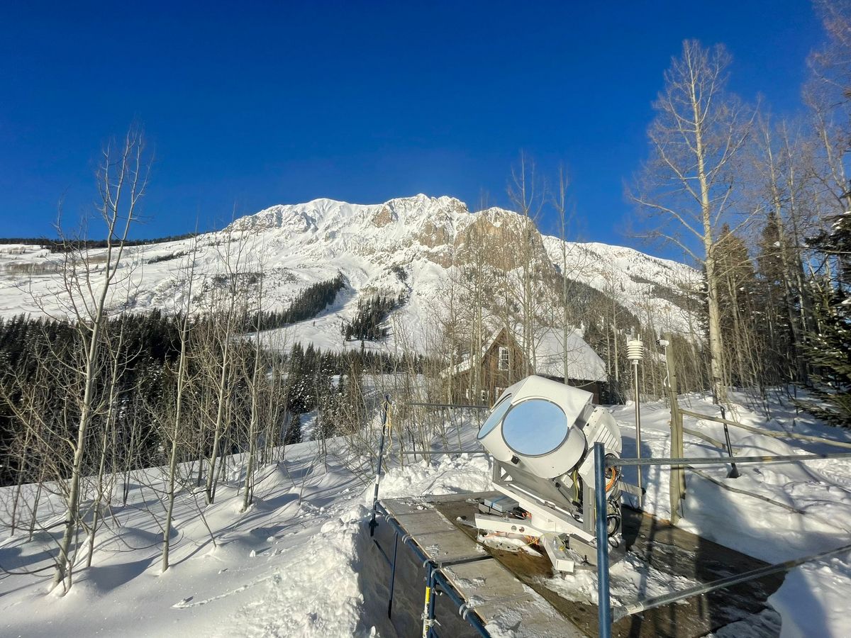
Subproject: Characterisation of orographically influenced ripening and secondary ice production and their effects on precipitation rates by radar polarimetry and Doppler spectra (CORSIPP)
Period: 01.01.2022 – 31.05.2025
Team: Anton Kötsche, Jun.-Prof. Dr. Heike Kalesse-Los, Dr. Maximilian Maahn, Dr. Veronika Ettrichrätz
Motivation
In mid-latitudes, most precipitation is generated through the ice phase in mixed-phase clouds, but the exact pathways through which ice, liquid water, cloud dynamics, orographic forcing, and aerosol particles are interacting precipitation formation are not well understood. This is particularly true for riming and secondary ice production (SIP) processes that are likely related to the largest uncertainties with respect to quantitative snowfall formation. Filling the gaps in our understanding of SIP and riming is especially crucial for mountainous regions that are particularly vulnerable to changes in the ratio between rain and snowfall.
Research Goals
The aim of our work is to identify riming and SIP events during snowfall in orographically-influenced regions and quantify their impact on snowfall rates.
• Goal 1: Determine the frequency of occurrence of riming and secondary ice production at an orographically-influenced site
• Goal 2: Determine the influence of riming and secondary ice production on snowfall rates at an orographically-influenced site
• Goal 3: Characterize external drivers for riming and secondary ice production processes and snowfall rates
• Goal 4: Advance the PAMTRA radar forward operator to improve the polarimetric modeling of ice particles.
Subproject: Polarimetry Influenced by CCN aNd INP in Cyprus and Chile (PICNICC)
Period: 01.01.2019 – 31.12.2023
Team: Teresa Vogl, Jun.-Prof. Dr. Heike Kalesse-Los
The PICNICC project’s goal is to improve our understanding of aerosol effects on microphysical growth processes in mixed-phase clouds. For this purpose, Doppler radar and lidar observations from a clean, pristine site in Punta Arenas (Chile, 53°S,71°W) and an aerosol-burden site in Leipzig (Germany, 51°N, 12°E), are compared and the contrasts in the microphysical fingerprints of mixed-phase clouds, specifically of pristine ice formation, riming and aggregation, are studied.
In the first step, a novel retrieval to detect riming even at orographically-influenced sites was developed (Vogl et al., 2022), and a software toolkit to analyze peaks in cloud radar Doppler spectra (Kalesse et al., 2019), was further developed and improved (Vogl and Radenz et al., 2023, in prep.). During the remaining time of the project, these techniques will be applied to the two data sets from Punta Arenas and Leipzig, and the results will be evaluated.
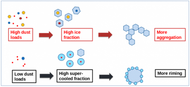
Our main hypothesis is, that the availability of ice nucleating particles (INP) drives the process by which ice grows in clouds in the temperature range between 0°C and -40°C, where liquid water can be present. When high concentrations of INPs are available, we expect clouds to glaciate at higher temperatures (Seifert et al., 2010; Kanitz et al., 2011), leading to aggregation being the dominant growth process. Opposed to this, if there is a scarcity in INP, liquid water layers will be more persistent. As a result, riming will occur more frequently than in high-INP conditions.
Data
In the winter 2022-2023, we operated an innovative simultaneous-transmission-simultaneous-reception (STSR) scanning W-band cloud radar (LIMRAD94) together with a novel video in situ snowfall sensor (VISSS) in the Colorado Rocky Mountains. Our observations enhanced the extensive measurements of the Atmospheric Radiation Measurement (ARM) Surface Atmosphere Integrated Field Laboratory (SAIL) campaign where a Ka-band and X-band radars were deployed.
Improving the power forecast of photovoltaic systems to support the energy transition and to investigate aerosol-cloud interactions PV-WOW
Project period: 01.01.2023 – 31.12.2024
Funding: European Social Fund Plus (ESF Plus)
Team:
- Junior scientists: Fani Alexandri, Felix Müller, Teresa Vogl, Dr. Jonas Witthuhn
- Project lead: Jun.-Prof Heike Kalesse-Los, Dr. Matthias Tesche
- Participating scientists: Dr. Michael Schäfer, Dr. Andreas Foth, Prof. Dr. Johannes Quaas, Prof. Dr. Manfred Wendisch
Cooperation partner:
- Dr. Hartwig Deneke (Leibniz Institute for Tropospheric Research)
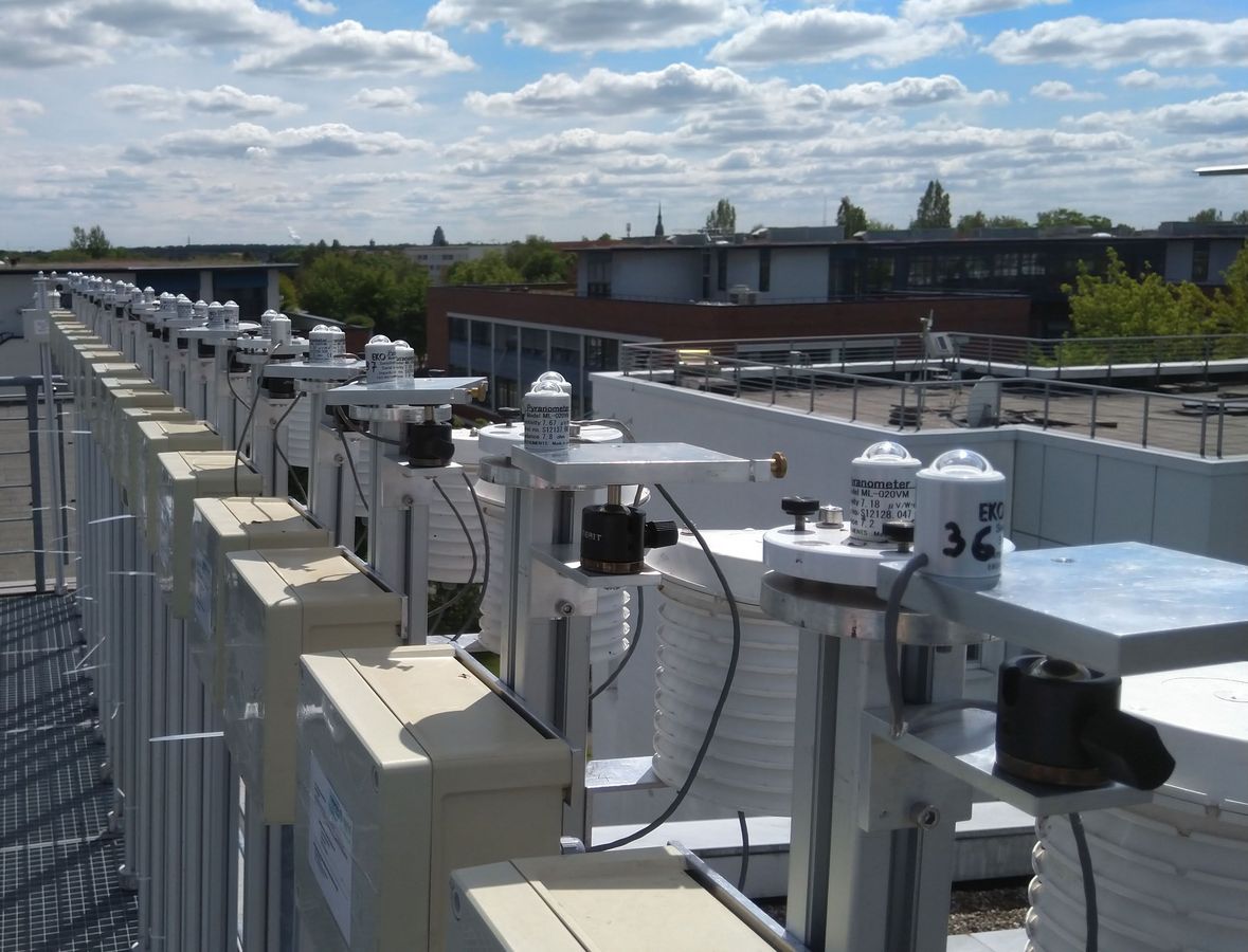
Ground-based and spaceborne remote sensing of the atmosphere is used for applied research on radiation, aerosols, clouds, and their interactions. It also provides important information for forecasting the generation of renewable energy. The type of cloud cover modulates the amount of solar radiation reaching the ground and thus influences the power generated by photovoltaic (PV) systems. Situations with broken cloud cover pose particular challenges. The causes are the extremely high variability of solar radiation, radiation reflected at cloud edges, and the influence of aerosol particles near clouds. By means of high temporal resolution solar radiation measurements with a spatially distributed pyranometer network, the radiation variability can be characterised for different amount of cloudiness and, in particular, for broken cloud cover. Such insights are significant for the planning and dimensioning of PV sites and power grids, and additionally provide scientifically relevant insights into aerosol-cloud interactions.
The high temporal and spatial resolution of today’s satellite observations enables unprecedented work on studying the behaviour of cloud properties over the life cycle of individual clouds, as well as the influence of aerosol particles on the properties of these tracked clouds.
Breathing Nature: Linking biodiversity, climate and human activity
Funding: Sächsisches Ministerium für Wissenschaft und Kultus
Period: 01.01.2023 – 31.12.2024
Climate change and biodiversity loss are two of the most pressing challenges facing humanity. Breathing Nature addresses the complex interactions between these two crises. These interactions are symbolised by the metaphor that nature is breathing: energy, water, gases, and particles are continuously exchanged between the biosphere and the atmosphere. Human behaviour can drive or also mitigate biodiversity and climate change.
Breathing Nature: Detecting insects in cloud radar signals
Team: Dr. Moritz Lochmann, Jun.-Prof. Dr. Heike Kalesse-Los
Flying insect biomass declined by 76 % from 1989-2016 in Germany (Hallmann et al., 2017). However, insects are vital to food security and a functioning ecosystem and trends in their amount or biomass need to be monitored wide-spread. In cloud- and weather radars observations, insects signals can be detected - albeit usually as an unwanted by-product (clutter).
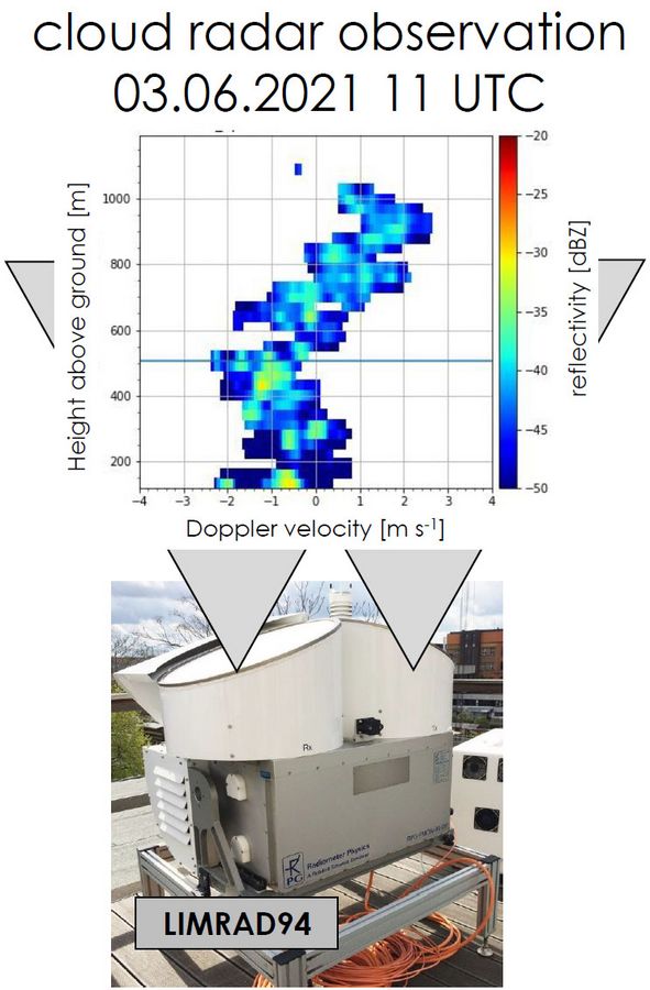
In this project, measurements of our vertically-pointing 94 GHz cloud radar LIMRAD94 in cloud-free situations are used to evaluate flying insect occurrence. Multiple approaches to identify insect signals in cloud radar data are used and compared with each other to investigate differences and similarities and to create a best-estimate of insect occurrence.
Dynamics, Aerosol, Cloud and Preciption Observations in the Pristine Environment of the Soutern Ocean (DACAPO-PESO)
DACAPO-PESO is a joint project of the Leibniz Institute for Tropospheric Research (TROPOS), Leipzig Institut of Meteorology, and Universidad de Magallanes. The goal is to study different processes involved in the formation of clouds and precipitation.
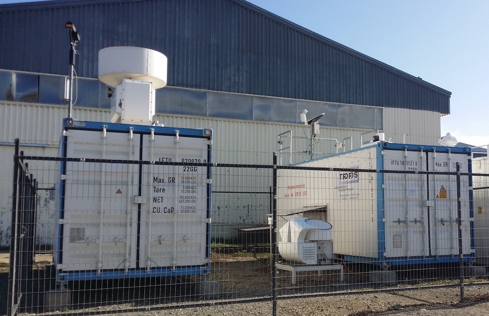
A three-year-long field campaign in Punta Arenas, Chile, located at the southernmost tip of South America took place from 2019 - 2021. This region is mostly influenced by clean marine air. Various remote sensing instruments were deployed, including LIMRAD94 and the TROPOS LACROS suite.
Further information can be found on the pages of the projects EUREC4A.
Team: Willi Schimmel, Teresa Vogl, Jun.-Prof. Heike Kalesse-Los
Elucidating the role of clouds-circulation coupling in climate (EUREC4A)
Work Package 3 Development of a cloud droplet concentration retrieval based on synergistic remote sensing observations (within EUREC4A field experiment) of Ground-based remote sensing of the atmosphere for improving the characterization of microphysical cloud properties and for improving the load prediction of renewable energies.
Team: Dr. Jonas Witthuhn, Anton Kötsche, Jun.-Prof. Heike Kalesse-Los
Funding:
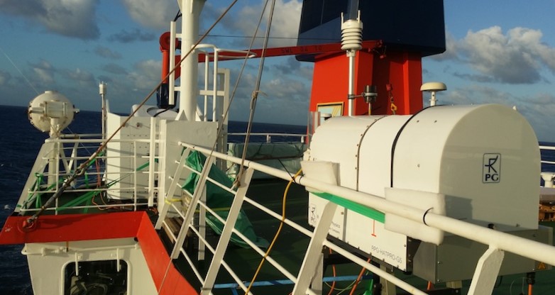
The core objective of the EUREC4A field campaign is to elucidate how macrophysical properties of trade-cumuli depend on the dynamical and thermodynamical properties of the environment in which the clouds form. The EUREC4A field campaign took place in the lower Atlantic trades, east of Barbados in Jan-Feb 2020. Onboard the German Research Vessel (RV) ”Meteor” we performed observations with our cloud radar LIMRAD94 and our microwave radiometer LIMHAT. Onboard the research vessel we for the first time successfully installed and tested the prototype of a passive Doppler cloud radar horizontal stabilization platform of a cardanic-mount type to assure zenith-pointing of the instrument.
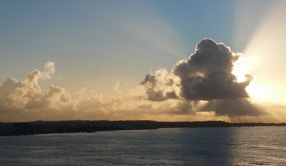
Precipitation of liquid clouds in the tropical Atlantic generally occurs as light rain or drizzle from stratiform cloud layers or as showers from well-developed trade wind cumuli. The rain often fully evaporates in the subcloud atmosphere resulting in virga. Our research question was how often virga occur in the trade-wind clouds observed during EUREC4A. Based on combined continuous observations of our cloud radar and a ceilometer, we developed a publicly-available virga detection tool, the so-called Virga Sniffer (Witthuhn et al., 2022; Kalesse-Los et al., 2023).
Publikationen
- Witthuhn, J. et al., 2022: Virga-Sniffer (v1.0.0). Zenodo, doi:10.5281/zenodo.7433405.
- Kalesse-Los, H., Kötsche, A., Foth, A., Röttenbacher, J., Vogl, T., and Witthuhn, J.: The virga sniffer – a new tool to identify precipitation evaporation using ground-based remote-sensing observations. Atmospheric Measurement Techniques, 16(6):1683–1704 (2023), doi:10.5194/amt-16-1683-2023.
A novel synergistic retrieval approach to enable tropospheric temperature and humidity profiling under all weather conditions for an improved quantification of evaporation rates
Funding: German Research Foundation
Project period: 01.04.2020 – 30.06.2024
Principal investigator: Dr. Andreas Foth
Partner: JP Dr. Heike Kalesse-Los
Cooperation partners:
- Dr. Volker Lehmann and Jens Reichardt, PhDs, Deutscher Wetterdienst, Lindenberg, Germany
- Dr. Johannes Bühl, PhD, Leibniz Institute for Tropospheric Research, Leipzig, Germany
- Jun.-Prof. Heike Kalesse, University of Leipzig, Leipzig, Germany
Summary:
The steady enhancements and improvements of weather and climate models is challenging for the remote sensing community. In order to evaluate and improve these models, the observations need to be enhanced. Common approaches fail to continuously observe temperature and humidity during all weather conditions and especially during rain. A wind profiling radar is capable to retrieve vertical information of the temperature and humidity gradient during such conditions. The proposed novel method based on a synergy between wind profiling radar (including a radio acoustic sounding system), Raman lidar, microwave radiometer, and cloud radar enables an automated and continuous observation of temperature and humidity profiles even during precipitation. The proposed variational method (optima estimation) provides a robust tool to combine various instruments with respect to uncertainties of the single systems. Within the optimal estimation, a given state (e.g. local climatology or last known state) is iteratively modified until it matches the measurements within their uncertainties. This method enables a comprehensive analysis of the uncertainties of the results and an assessment of the contribution of each single instrument.
The long term time series of data and the combination of complementary instruments, especially the 482 MHz wind profiling radar at Meteorologisches Observatorium Lindenberg – Richard Aßmann Observatorium is unique. The retrieved profiles of relative humidity will advance the atmospheric research community in many ways, such as the investigation of aerosol hygroscopic growth or cloud and precipitation formation or evaporation, respectively. Together with wind vector measurements from the wind profiling radar, the turbulent entrainment at the cloud boundaries can be quantified and help the community to evaluate turbulent entrainment rate parameterizations used in small scale models.
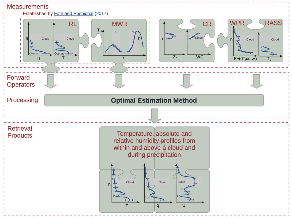
Instruments from left to right are Raman lidar (RL), microwave radiometer (MWR), cloud radar (CR), wind profiling radar (WPR) and radio acoustic sounding system (RASS). The variables in the diagrams are temperature (T), absolute humidity (q), integrated water vapour (IWV), brightness temperature (TB), reflectivity (Ze), liquid water content (LWC), temperature (dT) and humidity (dq) gradients, turbulence (w’), virtual temperature (Tv), and relative humidity (U).
Finished projects
Arctic Amplification: Climate Relevant Atmospheric and Surface Processes, And Feedback Mechanisms
Period: 01.01.2020 – 31.12.2023
Funding: German Research Foundation
Planet earth has warmed on average by 0.87 K over the past 150 years. In the Arctic, the warming is much larger, which became most prominent over the last decades. Currently, the Arctic warming exceeds the increase of near-surface air temperature in the mid-latitudes by about 2 – 3 K. This phenomenon is commonly referred to as Arctic amplification.

Subprojekt B07: Influence of sea ice leads or polynyas on Arctic cloud properties
Team: Dr. Pablo Saveedra Garfías, Jun.-Prof. Dr. Heike Kalesse-Los
The wintertime Arctic sea ice area is characterised by different degrees of fracturing. Openings in the sea ice start as narrow cracks which can develop to larger leads reaching hundreds of meters to kilometres width. Mostly near the coast and along landfast ice, extended areas of open water (polynyas) can develop. Leads and polynyas result in a substantial heat and moisture flux from the relatively warm ocean to the cold atmosphere. They thus alter the atmospheric boundary layer structure, cloud cover, and the surface energy budget and also affect atmosphere-ocean chemical exchanges. In a warming Arctic characterised by a thinner and more mobile sea ice cover, the distribution of leads or polynyas are expected to change, yet their interactions with the atmosphere are not fully understood. In this project, we are quantifying the influence of sea ice leads and polynyas on cloud properties such as cloud fraction, –altitude, –thickness, –phase, and their radiative effects in the Arctic winter. Results for the MOSAiC field experiment in the central Arctic are presented in Saavedra Garfias et al., 2023.
Saavedra Garfias, P., Kalesse-Los, H., von Albedyll, L., Griesche, H., Spreen, G.: Asymmetries in winter cloud microphysical properties ascribed to sea ice leads in the central Arctic. Atmos. Chem. Phys. Discuss., submitted on April 6, 2023, in revision, doi:10.5194/egusphere-2023-623
improving the load prediction of renewable energies
Project period: 01.03.2022 – 31.12.2022
Funding: European Social Fund in Saxony 2014 to 2020 (REACT-EU: funded as a part of the EU's reaction to the COVID 19 pandemic)
Team:
- Young resaerchers: Dr. Elena Ruiz Donoso, Moritz Lochmann, Willi Schimmel, Dr. Jonas Witthuhn
- Leader: Jun.-Prof. Dr. Heike Kalesse-Los
Cooperation partner:
- Institut for Tropospheric Research (TROPOS)
- Ingenieurbüro Last- und Energiemanagement - LEM -Software
The aim of the planned project is the connection of remote sensing of the atmosphere, machine learning and modelling to improve wind power prediction as well as to characterise cloud properties and the atmospheric water cycle.
-
The focus of work package (WP) 1 is on the development of a proprietary artificial neural network (KNN) for wind turbine power prediction. This KNN will be characterised by means of information and sensitivity analysis in order to find out which combination of observation or weather model input variables achieves the best power prediction.
-
In WP2, the cloud radiation effect for the Punta Arenas site in Chile is determined for two hydrometeor target classifications using radiative transfer modelling. The comparison will be based on the conventional Cloudnet hydrometeor mask and on that of the newly developed KNN-based cloud droplet detection algorithm "VOODOO". The latter is to be implemented in the Cloudnet software as a long-term goal.
-
Furthermore, the project plans to study the atmospheric water cycle in the subtropical Atlantic by using instrument synergies of radar lidar data on evaporating precipitation (Virga) from the international EUREC4A field measurement campaign (WP3).
-
The fourth sub-focus is on determining the cloud radiation effect of trade wind cumuli by means of radiative transfer calculations.
Ground-based remote sensing of the atmosphere for improving the characterization of microphysical cloud properties and for improving the load prediction of renewable energies
Project period: 01.09.2018 – 28.02.2022
Funding: European Social Fund in Saxony 2014 to 2020
Team:
- PhD students: Moritz Lochmann, Willi Schimmel, Johannes Stapf
- Principal Investigators: Dr. Michael Schäfer, Dr. André Ehrlich, Jun.-Prof Heike Kalesse-Los, Prof. Dr. Manfred Wendisch
Cooperation partner:
- Institut for Tropospheric Research (TROPOS)
- Ingenieurbüro Last- und Energiemanagement - LEM -Software
- Hochschule Mittweida - Arbeitsgruppe Computational Intelligaence and Techno-Mathematics
- Deutscher Wetterdienst (DWD) in Lindenberg
Goals:
Ground-based remote sensing of the atmosphere serves both, the basic research of clouds and precipitation, and in the operational service of weather forecasting as an important building block for the power prognosis of renewable energies. Within this project there are two main objectives: Firstly, it will be analysed how artificial neural networks (ANN) can be optimized for power forecasting of Photovoltaics (PV) and wind turbines, if additional data from weather stations and ground-based remote sensing measurements are implemented. On the other hand, in two further subprojects for cloud observations, retrieval algorithms will be developed to improve and extend the determination of cloud properties. The focus will be on instrument synergies for the derivation of cloud droplet concentrations and the development of application-specific ANN for the characterization of the distribution of liquid water in mixed-phase clouds. The project is divided into three work packages:
- AP1: Testing the influence of additional measurement data from weather stations and ground-based remote sensing on the power prognosis of PV and wind power plants using artificial neural networks (ANN) – RESEPCT
- AP2: Development of a cloud radar and lidar based ANN for detection of liquid water in clouds – VODOO
- AP3: Elucidating the role of clouds-circulation coupling in climate – EUREC4A
REmote Sensing for PowEr PrediCTions – RESPECT
Work Package 1 of Ground-based remote sensing of the atmosphere for improving the characterization of microphysical cloud properties and for improving the load prediction of renewable energies.
Team: Moritz Lochmann, Jun.-Prof. Heike Kalesse-Los
Cooperation:
Motivation
The growing energy production from renewable energy facilities comes with a decentralization of energy production and a certain variability in the amounts generated. Too much or too little energy in the electrical grid needs to be balanced. The larger the difference of production and consummation the larger (and therefore more expensive) the balancing needs to be. To keep variabilities in the grid as small as possible and thereby the grid stable reliable power generation predictions are needed.
The aim of RESPECT is to improve energy predictions based on large weather models by assimilating remote sensing data from measurements close to the wind/photovoltaics facilities into the artificial neural network doing the power prediction. We expect improvements especially for intraday forecasts.
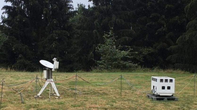
Renewable energy production in the context of the electrical grid
Companies operating renewable energy facilities need to deliver binding power generation predictions for the following day in the beginning of each day. Once these are handed in they can be adjusted slightly during the ongoing day as part of intraday forecasts. Generating more energy than predicted in a supersaturated electrical grid or generating less energy than predicted in an undersaturated grid is expensive for the company [generating less than predicted in a supersaturated grid (or vice versa) actually yields a profit]. Larger differences in the grid are balanced by the transmission system operator (german: “Übertragungsnetzbetreiber”). Generating more energy or distributing a surplus of energy on short notice is expensive and usually inefficient and needs to be minimized.
Remote sensing for power predictions
RESPECT is focusing on two specific means of renewable energy production – wind energy and photovoltaics. Naturally that’s also where the chosen measurement instrumentation excels. The project relies on the long running data set of the MOL-RAO (Meteorological Observatory Lindenberg – Richard-Aßmann-Observatory) by the German Meteorological Service DWD. Included are observations from Doppler lidar and wind profiling radar for wind velocity measurements. For radiation data the Cloudnet dataset (beginning Apr. 2004), consisting (most importantly) of Doppler cloud radar, microwave radiometer and ceilometer measurements, will be used.
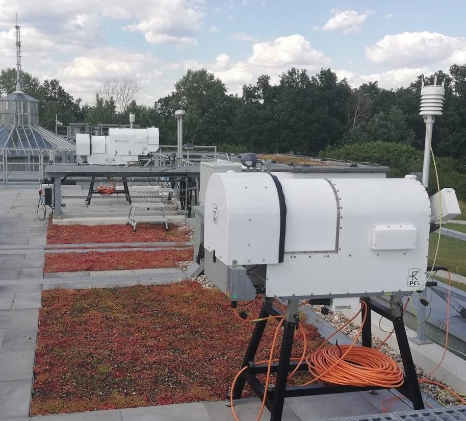
Field Experiment: Comparison campaign at MOL-RAO (Lindenberg, Germany)
In summer-fall 2020 the LIM measurement suite is in Lindenberg for a comparison campaign.
Instrumentation of Leipzig Institut of Meteorology
Publications
- Lochmann, M., Kalesse-Los, H., Schäfer, M., Heinrich, I. Leinweber, R.: Analysing wind power ramp events and improving very short-term wind power predictions by including wind speed observations. Wind Energy, 26(6):573–388 (2023), doi.org/10.1002/we.2816
reVeiling supercOOld Droplets beyOnd lidar AttenuatiOn using deep Learning
Work Package 2 of Ground-based remote sensing of the atmosphere for improving the characterization of microphysical cloud properties and for improving the load prediction of renewable energies.
Team: Willi Schimmel, Jun.-Prof. Heike Kalesse-Los
Cooperation partner:
- Deutscher Wetterdienst (DWD)
- Ingenieurbüro Last- und Energiemanagement LEM – Software
- Hochschule Mittweida - Arbeitsgruppe Compuational Intelligence und Techno-Mathematik
Motivation
Complete characterization of the distribution of liquid water and ice in clouds is critical to determine cloud lifetime, precipitation efficiency, and radiative forcing. Identification of liquid water layers throughout the vertical column in mixed-phase clouds remains a major challenge even with synergistic measurements using ground-based high-resolution cloud radar and polarization lidar. The reason for this is that while polarization lidar measurements are very good for distinguishing ice from liquid water, the lidar signal cannot fully penetrate optically thick clouds. If liquid water layers occur in the lower part of the cloud or deeper liquid water clouds completely attenuate the lidar signal, only cloud radar measurements are available in the upper part of clouds, but these are not very sensitive to small cloud droplets. However, novel synergistic evaluation techniques can help to infer the existence of liquid water layers purely from cloud radar measurements.
Goal
The objective is to develop an artificial neural network (ANN) trained by parallel cloud radar and lidar measurements in thin or the lower layers of thick mixed phase clouds. By predicting lidar backscatter signal, it subsequently provides information on the existence of liquid water in higher cloud layers.
The long-term goal of the project is to improve cloud phase classification within the European "Cloudnet" cloud remote sensing network, which in turn is embedded in the European research infrastructure project "ACTRIS" (Aerosols, Clouds, and Trace gases InfraStructure Network).
Measurement data
Cloud radar and lidar measurements from the mobile "Leipzig Aerosol and Cloud Remote Observations System" (LACROS) remote sensing station of TROPOS form the data basis. Measurements are collected as part of the DACAPO-PESO measurement campaign in Punta Arenas, Chile. Through this measurement campaign, a unique cloud data set will be obtained in the poorly explored mid-latitudes of the Southern Hemisphere. Data from the following instruments will be used:
- FMCW-94 GHz Doppler cloud radar LIMRAD94 (LIM)
- HATPRO microwave radiometer (TROPOS)
- Ceilometer Jenoptik/Lufft CHM15k-x (TROPOS)
- Model data from the European Centre for Medium-Range Weather Forecasts (ECMWF)
Publications
- Schimmel, W., Kalesse-Los, H., Maahn, M., Vogl, T. Foth, A., Saavedra Garfias, P., Seifert, P.: Identifying cloud droplets beyond lidar attenuation from vertically pointing cloud radar observations using artificial neural networks. Atmospheric Measurement Techniques, 15(18):5343–5366 (2022).
